


SeaView© PRO & Sport–The data you need, when you need it.
Engineered for under, at-sea, field or operational support conditions, Ocean Imaging's SeaView© fishing software is the most powerful oceanographic data analysis tool on the market – in any price range – worldwide. SeaView Desktop delivers the latest satellite oceanographic and weather data ready for download and display via the SeaView© software installed on your boat, home, or office computers.
Discover the Power of SeaView
Data are available in near-real time via a broadband, cellular hotspot, or satellite phone internet connection 24/7! Our SST, sea height, ocean current, sub surface temperature, chlorophyll/plankton, salinity, mixed layer depth and weather data products will significantly improve your fishing experience and bottom line by enabling you to analyze and identify the most productive fishing locations faster, while consuming less fuel.
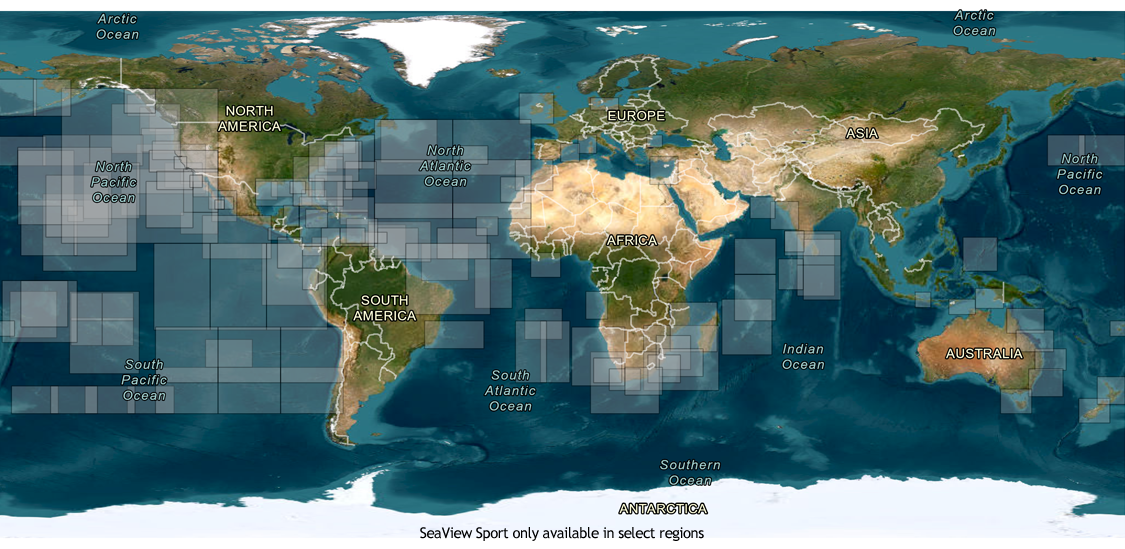
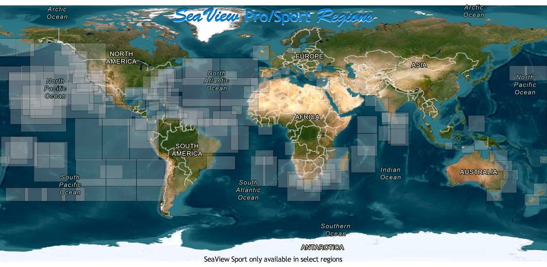
Once downloaded, all data files are permanently stored on your computer—until you delete them— for use when an internet connection is unavailableSeaView Pro/Sport Coverage
| SST Single Satellite Overpass | |
| Resolution: .75 - 2.5 km Updates: Up to 12x /day! Highest accuracy and resolution SST products delivered worldwide faster than anyone! |
|
| SST Composite | |
| Resolution: 2 - 4 km Updates: 1x / day Two types of cloud-filtered 1-day and 3-day SST composites. |
|
| Cloud-Free SST | |
| Resolution: 4 - 10 km Updates: 1x / day Always-cloud-free model and microwave-derived SST imagery. These data productsare invaluable during periods of heavy cloud cover. |
|
| Chlorophyl / Plankton | |
| Resolution: 1 - 2.5 km Updates: 2 - 4x / day The highest detail and accuracy ocean phytoplankton data (Chlorophyll) imagery available. |
|
| Chlorophyl / Plankton Composites | |
| Resolution: 1 - 2.5 km Updates: 1x / day The highest accuracy 5-day ocean chlorophyl composite imagery to help reduce cloud cover problems. |
|
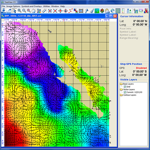
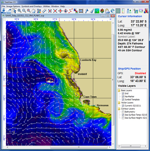
| Ocean Currents: Speed & Direction | |
| Resolution: 500m - 10km Updates: 1 - 4x / day Four types of ocean surface currents available for overlay on top of any oceanographic, weather or base map image. |
|
| Subsurface Temperature | |
| Resolution: 2 km Updates: 1x / day 25m, 50m, 100m and 200m subsurface ocean temperature imagery. |
|
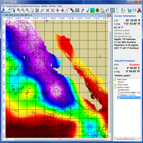
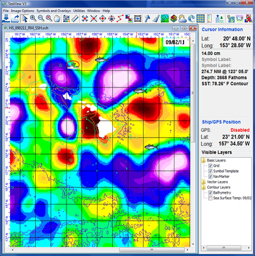
| Sea Surface Height Anomaly | |
| Resolution: 2 - 4 km Updates: 1x / day Locate oceanographic convergence zones in all cloud cover and weather conditions with either Sea Surface Height (SSH) or Sea Surface Height Anomaly (SSHA) imagery. |
|
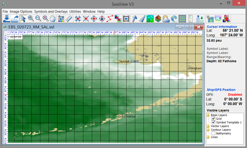
| Salinity | |
| Resolution: 2 km Updates: 1x / day High-accuracy ocean salinity. |
|
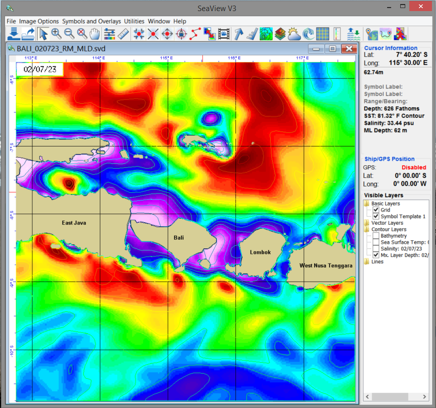
| Mixed Layer Depth | |
| Resolution: 2 km Updates: 1x / day The depth of the ocean’s upper, mixed layer – often analogous with the thermocline depth. |
|
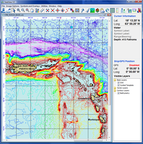
| Bathymetry | |
| Resolution: 100 fathoms High detail ocean bottom topography worldwide. |
|
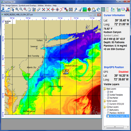
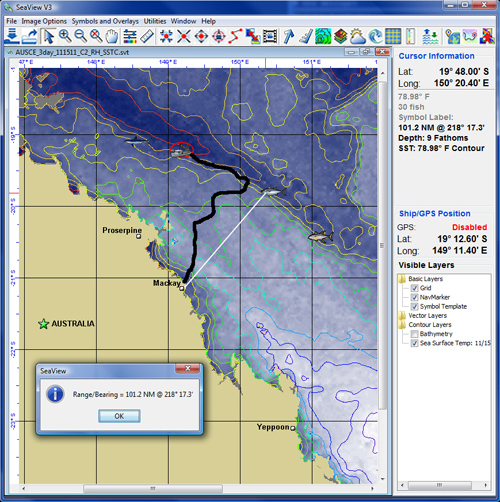
| Symbols, Navigation Markers & GPS with Tracklines | |
| GPS (NEMA-183) interface for vessel positioning & tracking display on imagery. Tracklines can be saved and re-loaded over any image.
User defined symbols (fish, boats, custom symbols), navigation markers and template overlays allow marking of high-points, fish & map locations, survey sites or ship tracks. |
|
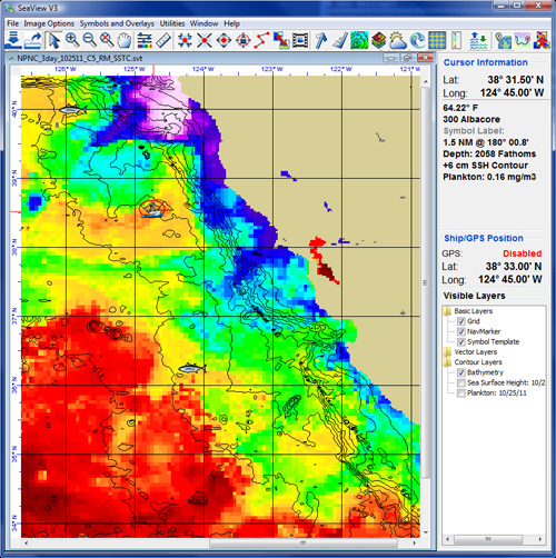
| Data Overlay Capability | |
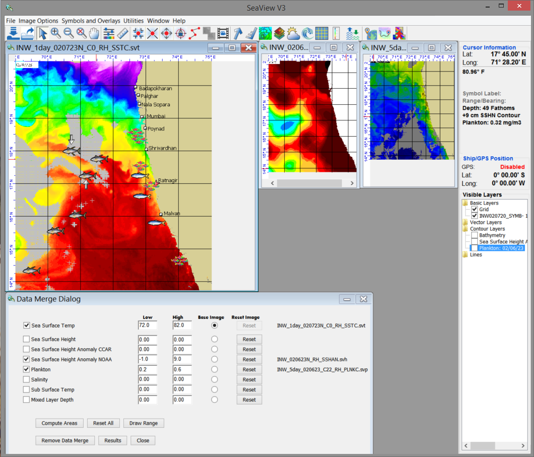
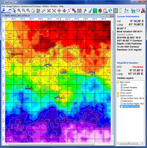
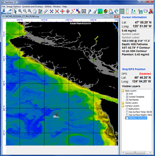
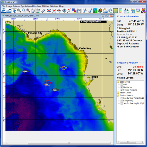
| Display several types of oceanographic and/or weather information simultaneously (either side-by-side or as contour overlays) to compare data types or conditions from one day to another. Load boat position, lat/long grid, ocean current arrows, ocean surface winds, weather contours, plankton, SST & SSH contour lines, and bathymetry over any image or base map. Cursor driven latitude/longitude position detection of any image feature with zoom-in and custom image enhancement capability. | |
| SeaView Exclusive Data Merge Tool | |
| Combine oceanographic parameter ranges such as SSHA, SST, chlorophyll, salinity, etc., to determine where the best mix of the proper conditions exist for your target species.
|
|